Our Locations

North Plympton - Main Office

A: 275 Marion Road, North Plympton South Australia SA 5037

T: 08 8297 0883

F: 08 8297 1170

Port Lincoln

A: 100 Tasman Terrace, Port Lincoln SA 5606

T: 08 8682 5199

Clare

A:192-194 Main North Road, Clare SA 5453

T: 08 8842 1364

Gawler

A:32 Adelaide Road, Gawler, SA, 5118

T: 08 8523 0168

Berri

T: 08 8582 2501

Waikerie

T: 08 8541 2676

Online Enquiry

Please call me back
* Required fields

Write a Review

* Required fields

What We Offer


Cadastral Surveys

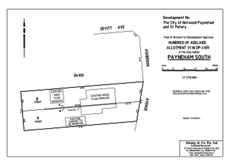
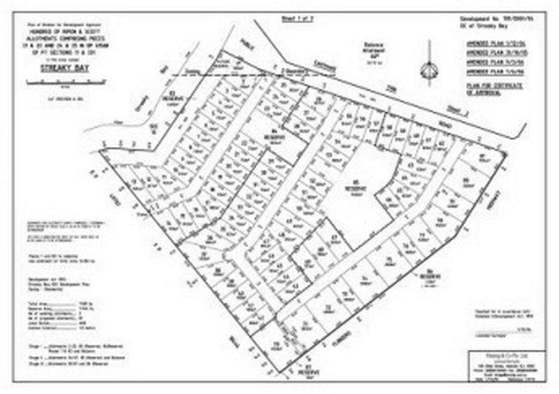
Includes all aspects of surveys and plans for prescribed Cadastral Surveys:


Division of Land

Freehold Land

  • Subdivision of parcels of land into smaller residential and rural allotments, including:
    • Party wall surveys.
    • Preliminary design and layout
    • Feasibility study
    • Planning Approval from Statutory Authorities
    • Surveying and pegging of allotments
    • Road Design
    • Application for titles with Registrar Generals' Office 

Leasehold Land

As for freehold land except application for tenure with Department of Environment Heritage

  • Division of Land for Shack Sites
  • Identification Surveys including encroachment situations
  • Road Opening and Closing surveys and plans
  • Strata Title Surveys
  • Community Title Surveys
  • Mining Surveys
  • Lease Plans using Property Council of Australia guidelines
  • Easement Plans
  • Amalgamation of Certificates of  Title
  • Liquor Licensing Act surveys
  • Project Management coordinating Statutory Authorities and Contractors
  • Title Searching & Land Information Enquiries

Engineering Surveys

  • Road & Bridge Construction
  • Building set out
  • Structural Steel work
  • Site Details
  • Drainage
  • Earthwork volumes
  • Multi-Storey construction
  • Checking of contractors and liaison with project managers, etc.
  • Forestry, horticultural, irrigation applications

Hydrographic Surveys

  • Preliminary and post dredging surveys for determination of volumes
  • Supervision of surveys with respect to dredging operations
  • Surveys with respect to construction and dredging of Yacht Mooring facilities
  • Set out Deep Sea Moorings
  • Set out of piles & sheet piling for mooring and harbour facilities

Topographic Surveys

  • Contour and detail surveys in plan and digital format for Commercial, Residential, Horticultural and Rural allotments.
  • Control for photogrammetric mapping using conventional and Global Positioning System (GPS) methods

Land Development Consultants


Project Management

  • Supervision of Land Division Applications, including construction of roads & services
  • Part of consultancy team for major subdivisions eg: 500 Residential allotments & Golf Course development - Victor Harbor
  • Total supervision of numerous subdivisions - up to 500 allotments of most areas in South Australia
  • Supervision of large Community Title Projects involving multi-storey and commercial schemes, including construction or roads and services

GPS Surveys

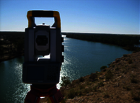
Control survey for large scale mapping